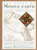
Karen Wynn Fonstad’s cartographic study provides a geographical framework for J.R.R. Tolkien’s secondary world across the First, Second, and Third Ages. Using geological principles, the author illustrates the physical evolution of Arda, from the initial symmetry of the Valar’s creation to the cataclysmic sinking of Beleriand and Númenor. The book contains detailed maps of specific regions like the Shire and Mordor, alongside architectural floor plans for structures such as Orthanc and Bag End. Fonstad synchs these maps with chronological timelines to track the specific daily movements of the Fellowship and various armies.
This atlas serves readers and researchers who require spatial clarity while navigating Tolkien’s dense narratives. It functions as a technical reference for visualizing the distances between landmarks and the topographical obstacles faced by specific characters. By engaging with these diagrams, the reader gains a precise understanding of Middle-earth’s scale and the logistics of its migrations. One walks away with a clear mental image of how tectonic shifts and historical battles fundamentally reshaped the continent’s borders and terrain over thousands of years.
Outward-looking and clear-cut; a moderate read.
Best for readers like The Evidence Seeker. Which reader are you?
- Published
- 1981
- Language
- EN
Books like The Atlas of Middle-earth
See all 12 →